AirHunt
A real-time aerial object-navigation system that connects VLM semantic reasoning with continuous UAV planning.
Overview
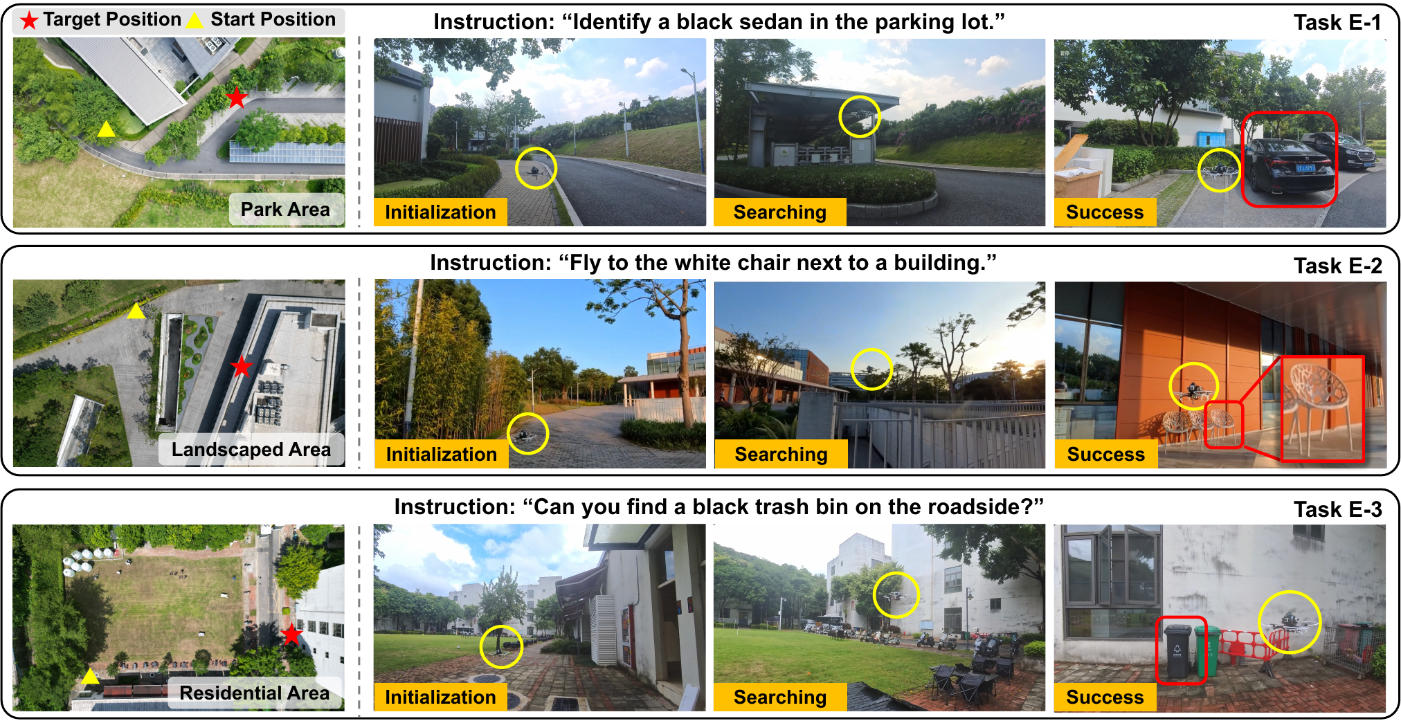
AirHunt is a real-time aerial navigation system for large-scale unknown outdoor environments. It accepts natural-language objectives and bridges high-latency vision-language reasoning with low-latency UAV replanning for zero-shot object navigation.
My contribution
- Designed the high-frequency geometric path planner and the low-frequency VLM semantic-reasoning module.
- Built the ROS-based communication layer connecting perception, reasoning, planning, and control.
- Implemented baselines and ablation studies, then built and deployed the custom AirHunt quadrotor platform.
Technical approach
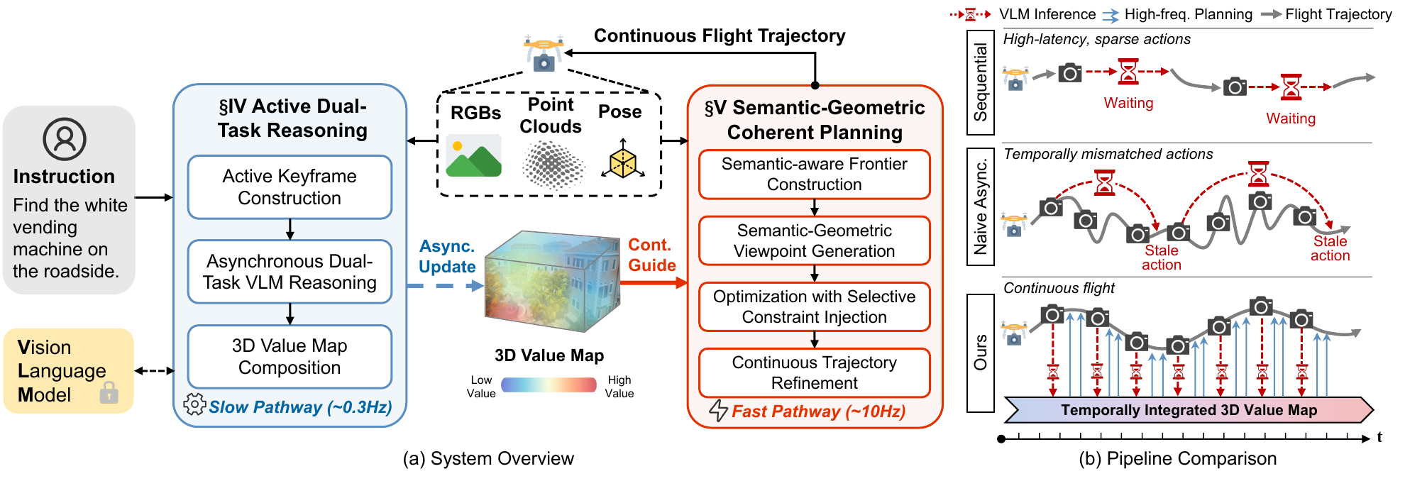
Dual-pathway architecture
Decouples slow VLM inference from fast UAV replanning so that the drone can fly continuously.
Decouples slow VLM inference from fast UAV replanning so that the drone can fly continuously.
Active dual-task reasoning
Selects coverage-aware and task-aware keyframes for efficient semantic reasoning and target verification.
Selects coverage-aware and task-aware keyframes for efficient semantic reasoning and target verification.
Semantic-geometric planning
Builds a persistent 3D value map and balances semantic priority with geometric travel efficiency.
Builds a persistent 3D value map and balances semantic priority with geometric travel efficiency.
System deployment
Integrates perception, reasoning, planning, and control through ROS for AirSim and real-world flight.
Integrates perception, reasoning, planning, and control through ROS for AirSim and real-world flight.
Results
73.1%average navigation success rate across 85 simulation episodes
11.6 maverage final distance to the target
120.8 saverage end-to-end flight time
10+ houtdoor real-world flight validation